Digital Mapping of Agroecology Inititatives in Senegal
Connect - Promote - Build Synergies
One of the central objectives of the ARTS project is to move beyond the “islands of success” syndrome, where promising initiatives remain isolated and struggle to create impact beyond their immediate context. The georeferenced mapping of agroecological initiatives has emerged as a key tool to connect stakeholders, enhance the visibility of their efforts, and foster synergies across territories. By offering a dynamic, overarching view, this mapping acts as an online directory of initiatives, facilitating exchanges and collaborations.
The Process: From Local Identification to Digital Integration
The mapping process begins with the DyTAELs (Dynamics for Local Agroecological Transformation), which organize participatory workshops to identify existing agroecological initiatives. These initiatives are then visited by research teams who conduct in-depth interviews and complete detailed questionnaires. The collected data includes key information on agroecological practices, challenges faced, and the precise geolocation of each initiative.
Once gathered, these data are integrated into an online interactive map. This platform not only visualizes the geographical distribution of initiatives but also provides detailed information about each one, including the types of practices, partners involved, innovations developed, and more.
Benefits of the Interactive Map
The interactive map offers several tangible advantages:
- Connecting Stakeholders: By networking agroecological initiatives, it promotes the exchange of experiences and best practices.
- Highlighting Local Efforts: Increased visibility strengthens the legitimacy and attractiveness of initiatives to potential partners and funders.
- Encouraging Synergies: By identifying complementarities between initiatives, the map fosters collaborations and resource sharing.
- Supporting Strategic Planning: Decision-makers can use the comprehensive overview to inform policies and prioritize interventions.
Expanding the Tool’s Reach
Currently, the ARTS project focuses on the Bignona and Mbour departments. However, the next step is to transfer the mapping tool to the DyTAES (Dynamics for Agroecological Transition in Senegal). This will not only enrich existing data but also extend the initiative to other regions of the country. This transfer aims to ensure the tool’s sustainability while making it accessible to local stakeholders, who will be able to identify new initiatives and autonomously enrich the database.
In essence, this interactive mapping represents an innovative and inclusive approach to supporting the agroecological transition. It embodies a vision where agroecology grows not only through individual action but also through collective intelligence, enhanced by modern and accessible tools.
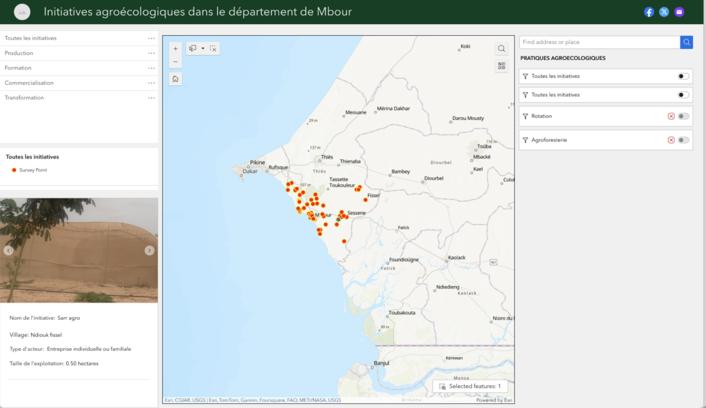
Interactive map Mbour
Visualize, contextualize, analyze agroecology initiatives in the Mbour Living Lab
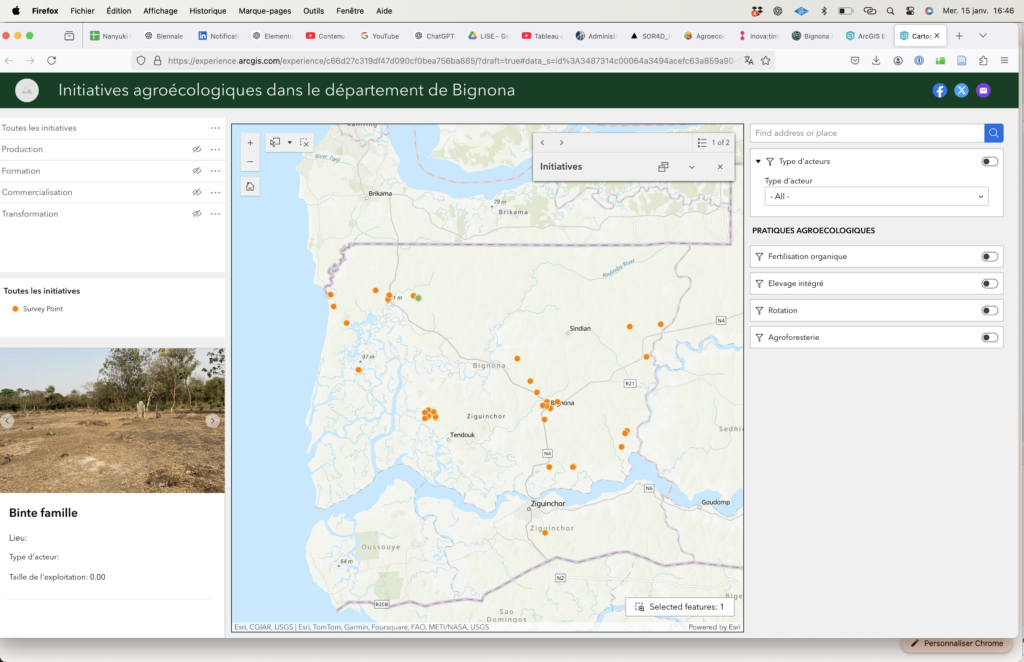
Interactive map
Bignona
Visualize, contextualize, analyze agroecology initiatives in the Bignona Living Lab